Blizzard 2015: How did the forecasts get it so wrong?
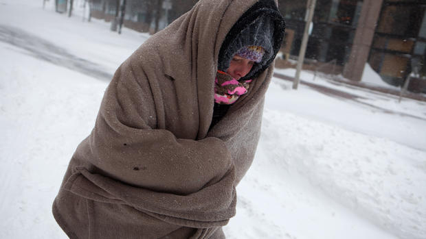
It was supposed to be the storm of the century, a blizzard like no other that would dump two feet of snow on New York City and shut the Big Apple down for days.
Instead, New Yorkers awoke Tuesday to several inches of snow on the ground. Roads were mostly clear and the only headache was the fact the city had shut down the subways over fears of the impending snowstorm.
So what happened? How could the weatherman have gotten it so wrong?
Some blamed models used by the National Weather Service for failing to accurately predict the path of the storm while others said it was simply a case of not communicating the wide range of forecasts for this storm.
The National Weather Service over the weekend had issued a blizzard warning for a 250-mile swath of the region, meaning heavy, blowing snow and potential whiteout conditions.
In the end, many of those warnings failed to materialize although parts of Long Island and New England were experiencing heavy snow and strong gusts.
The debacle prompted Gary Szatkowski, a meteorologist at the National Weather Service in Mt. Holly, N.J. to take to Twitter to apologize. "You made a lot of tough decisions expecting us to get it right, and we didn't. Once again, I'm sorry," Szatkowski tweeted.
Szatkowski was described as one of the "heroes" of Superstorm Sandy for getting predictions about that storm's severity right, and for broadcasting them loudly.
NJ.com reports that Szatkowski "issued some of the strongest warnings that anyone in the weather community had seen from a meteorologist in his position. He went from warning people about the potential dangers of the storm on that Tuesday to practically begging them to evacuate five days later in what he titled a 'Personal Plea' in his briefing packet."
Meteorologist Megan Glaros of CBS stations WBBM said there was no need to apologize for this blizzard, calling forecasting an "inexact science." She also pointed out that forecasts in other areas like Maine and Boston were correct.
- CBSN video: Why winter storm didn't pack the promised wallop
"What you have with a storm like this is so many things that can change," she said. "You are dealing with the Atlantic Ocean. You are dealing with so many factors and minor changes can mean a big shift where those heavy snowfall totals are. So to apologize for this when the National Weather Service saves countless lives seems to me to be something those guys shouldn't have to do."
The National Weather Service's Director Louis Uccellini also stood behind the forecast, telling reporters that "billions of atmospheric data points are run through complex computer models" and combined with satellite and radar imagery to "give us the best information we have about the storm's track, intensity and precipitation distribution."
But there still remains plenty of uncertainty especially with the models used to make these forecasts.
"Heavy snow forecasts can be notoriously difficult, since our computer models struggle to accurately predict where the very narrow bands of heavy snow with snowfall rates of 2 to 4 inches per hour will set up," Jeff Masters and Bob Henson, writing a blog post on the Weather Underground website, said. "Furthermore, an error of 50 miles in predicting the track of the storm can make a huge difference in snowfall amounts, and a 50-mile error in track in a 24-hour forecast is fairly common for a storm system 1,000 miles across."
The National Weather Service depended mostly on two models to predict this storm - a European model and a newly installed American GFS model. The American model offers higher resolution - essentially more data points closer together - and was much more accurate, putting the storm further East.
"Forecasts that relied too heavily on the European model put too much snow over New York City," they wrote.
However, other meteorologists were less critical of the forecast, saying the storm veered about 15 miles east of New York City, which made all the difference.
"I don't think anything went wrong. This was a really good forecast in many, many ways," said Keith Seitter, executive director of the American Meteorological Society who said the forecast where he lives in Boston was spot on.
"These kind of storms always have a very sharp boundary on the western edge - a sharp dividing line between areas that get heavy snow and area s that don't get very much," he said. "This forecast was very good in terms of the tracking the storm but New York and New Jersey were right close to that edge."
Seitter also defended the response of New York City Mayor Bill DeBlasio, who came under fire from some New Yorkers for shutting down the subways and instituting a traffic ban across the city from 11 p.m. onwards.
"If you have a situation where you know that you are that close or have that culpability of getting a major snow fall, it would be irresponsible not to take precautions based on that," he said. "If you come out of the storm and say wow that is not as bad it was going to be that means everything worked perfectly. That means you have assets in place. That means you had preparations in line and that people listened."
Uccellini also defended the response of state and local officials to what he called a very dangerous storm, saying their actions "proved we can reduce needless accidents and deaths due to weather events if we are willing to make the tough decisions."
But Uccellini also acknowledged that "we all need to improve how we communicate forecast uncertainty and the National Weather Service, moving forward, will be more aggressive in addressing this particular component of the forecast."
Among the missteps the agency will be looking at are the language used to describe the storm - words like historic were put out in releases one point - and why forecasters stuck for an extend period of time with an unidentified model that projected a large amount of precipitation over New York City.
"I'm not going to sit here and do a hindcast. Those become rather easy with 20-20 hindsight," Uccellini said. "But we are going to review those procedures with respect to portraying more exact amounts."