Huge iceberg shown breaking up in NASA satellite's infrared image
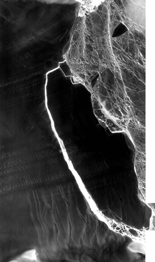
It's pretty dark in Antarctica right now, but that didn't stop NASA's Landsat 8 satellite from using its thermal infrared imaging powers to get a good look at the spectacular iceberg that broke away earlier this month. The floating ice chunk is one of the largest on record.
The iceberg, saddled with the uneventful name A-68, separated from the Larsen C ice shelf and immediately got compared in size to the U.S. state of Delaware and the amount of water in Lake Ontario.
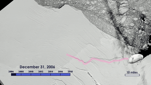
The Landsat view is a composite created from images taken on July 14 and July 21 by the satellite's Thermal Infrared Sensor. The satellite has monitored the natural phenomenon over the course of its evolution from a thin crack to a full-blown iceberg.
A full set of Landsat images shows the calving process from February 2016 through July 21, 2017, when the iceberg is clearly separated from the ice shelf.
The large image below shows how small chunks of the iceberg are already separating from the main mass. NASA reports A-68 is currently heading northward on ocean currents.
This article was originally published on CNET.