Newest Weather Service forecasting tool: Supercomputers
CBS News is getting a first look at the National Weather Service's two powerful new supercomputers. The National Oceanic and Atmospheric Administration says the upgraded system gave early warnings for the recent storms in the South. The computers are part of a nearly-$45 million project to boost the country's forecasting capabilities.
The identical supercomputers are housed in Virginia and Florida, reports CBS News correspondent DeMarco Morgan. They can do a combined 5.78 quadrillion calculations per second, nearly four times more than the old system. The National Weather Service hopes the upgrade will help them stay ahead of the storm, literally, and put the U.S. on par with Europe, which has dominated the world of forecasting technology.
Last fall's flooding from Hurricane Joaquin in the South and this winter's monster blizzard in the Northeast were predicted early and accurately by the upgraded computers.
Longer lead time gave people a chance to prepare.
"We know forecasts save lives," National Weather Service director Louis Uccellini said.
"As we get closer to an event, we can make the forecast with greater resolution and more accuracy so people can see where, specifically, the storms will affect," Uccellini said.
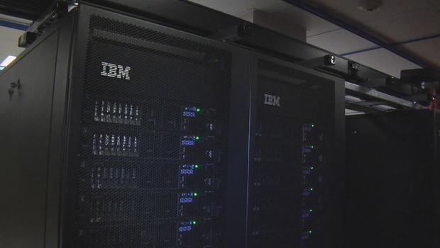
"Luna" is half of the government's $44.5 million improvement to its forecasting system. Trillions of observations are gathered from weather balloons, satellites and buoys, among other things. The supercomputers then run models based off that data to predict the weather.
The American model, known as GFS, miscalculated the path of Superstorm Sandy in 2012. The hurricane killed nearly 150 people and caused an estimated $68 billion of damage.
"Sandy was certainly a turning point in the entire enterprise," Uccellini said. "It really brought attention to ... the supercomputing capacity that we had prior to Sandy versus what other operational centers around the world had."
Five days before the storm, the European model correctly predicted that Sandy would slam into the New Jersey shoreline. A severe weather expert with CBS New York, Lonnie Quinn, explained how the predictions varied.
"This green line, this is the European Model's forecast -- this is about a week away from landfall," Quinn described.
The American model, shown in orange, shows a decidedly different route.
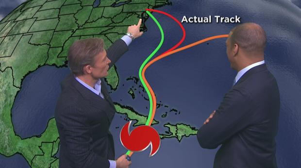
Asked to show the actual storm path, Quinn said, "You're gonna laugh because, remember, the European models track and look at how the storm actually performed," Quinn said. "Yes, it actually went farther out to sea but it took a hard left hang bang and you zoom in tight on that and the landfall because the European and the actual landfall -- maybe about a 50 mile difference or so."
In 2015, a National Weather Service employee tweeted an apology for overestimating a snowstorm that turned out to be a bust.
The agency believes the new system will also help forecasters get a better handle on short-term, daily predictions, not just big weather events.
"We're gonna see a wealth of information coming at us over the next year ... which lends me confidence that we'll be producing a better forecast," Uccellini said.
The computers took about 10 months to install. Currently, the specific models like the ones that analyze fires and hurricanes are being transferred onto the new operating system. Those should be fully up and running by July, just in time for hurricane season.